Tuesday, April 14, 2009

Photo: Indianapolis Cultural Trail, Photo 12


If you have time, check out the Northeast Corridor Construction Kick-Off today. The event begins at 1:30pm at the location pictured here, the alley behind Chatham Tap and Scholars Inn on Mass Ave. In case of inclement weather, the event will be held across the street at the Firefighters Union Hall, 748 Mass Ave.

Sunday, April 12, 2009

Saturday, April 11, 2009

Thursday, April 9, 2009

Photo: Indianapolis Cultural Trail, Photo 11


A pre-construction shot of Walnut St., looking east from the intersection of New Jersey St. The Cultural Trail will be a combined trail (pedestrians and bicycles share) on the left side of the street at this location.

Wednesday, April 8, 2009

Photos: Southeast Corner of West and Washington

I was going through some photos from a couple months ago and found a couple of this open lot at the corner of West and Washington. With 1626 hotel rooms going in across the street -- and all the wallets and purses that will be staying there -- how long will this lot stay empty? I can't confirm, but I assume the State of Indiana owns this lot and has it earmarked for State office expansion. With the convention mega-complex to the south of this location, though, it might be in everybody's best interest for the State to give up this lot and consider expanding north from the Statehouse if they need space in the future.

Looking East, with Washington St. and the Indiana Government Center on the left.


Looking West, with West St. at the top and the JW Marriot beyond.

Tuesday, April 7, 2009

Photos: Multimodal Node

Near the southern terminus of the Monon Trail at 10th St., there's a pretty interesting criss-crossing of transportation systems. Consider this list:
  • Interstate Expressway - I65/I70 Interchange
  • Freight Railraod - CSX Railroad
  • Urban Street - 10th St.
  • Urban Sidewalk - 10th St.
  • Rail-to-Trail Recreational Path - Monon Trail
  • Future Urban Bike and Pedestrian Path - Northeast Corridor of the Indy Cultural Trail
  • Proposed Commuter Rail - Northeast Corridor
There are so many systems it's difficult to capture them all in one photograph. Here's my best attempt, looking south across 10th St.:

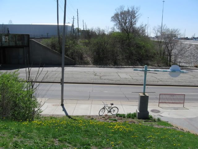
You can see the CSX line and I65/70 at the upper corners, 10th St. and its sidewalks in the middle, the Monon Trail at lower-right where it will meet the Cultural Trail (it will head to the right off the photo) and finally, I'm standing on the proposed commuter rail route, which would go due south over 10th St. on a bridge at this location.

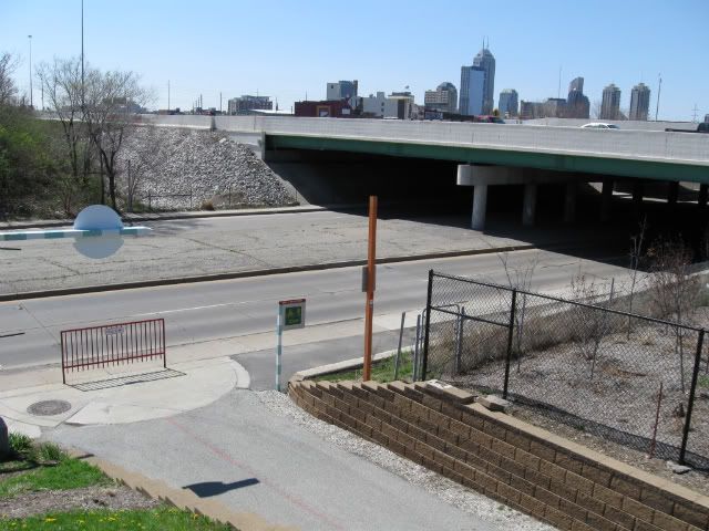
This photo doesn't capture the all the systems but I've included it because I think it's a better photo overall:

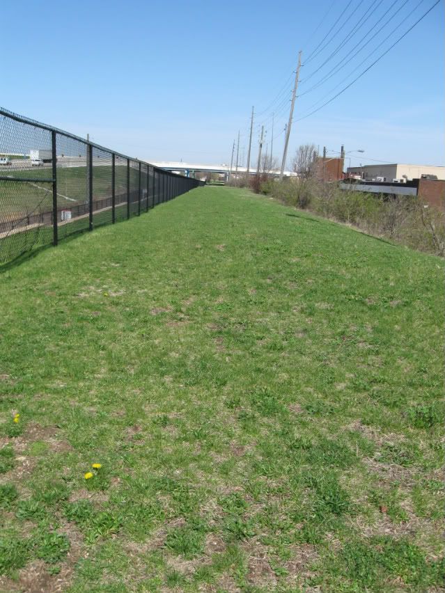
Turning around looking north, you see the proposed route for a commuter rail line serving Indy's northeast suburbs out to Noblesville, the former Nickel Plate Line.

Just to the right of the route sits this little building. I'm not sure what its purpose was, but it was certainly related to the rail lines that passed by this location.

Monday, April 6, 2009

Photos: Signs at Buggs Temple, Finally


It's not like anyone is going to miss the restaurant action on the canal side, but I have to think that branding the building on that side would help business as well.

Sunday, April 5, 2009

Photo: Indianapolis Cultural Trail, Photo 10

Looking east on North St. from the corner of Alabama St., the first signs of construction on the Northeast Corridor are visible.
Photobucket