Then sometime in the last year or so, this warehouse went on the market (east side of Senate Ave., between St. Clair St. and Walnut St., previous tenant unknown):

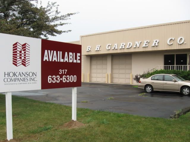
Then a couple weeks ago, this warehouse went on the market (St. Clair St. and the Canal, formerly B.H. Gardner Co.):

And now, as of a week or so ago, this warehouse is on the market (St. Clair St. and Capitol Ave., formerly Litho Press Inc.):

The former Litho Press building is a full quarter-block, four story building at St. Clair St. and Capitol Ave. It's just begging for a first rate refurb that opens up the huge window openings that were bricked-up years ago. It could be a great residential loft conversion, though many other uses are certainly possible. An 88 space parking lot is associated with the building. Here are a couple photos that show the detailing on this old warehouse:

The Southeast corner of the building, St. Clair St. facade.

Same location, focusing on the roofline.

Looking West at the Capitol Ave. facade.

Same location, focusing on the detail around the main entrance.

The Northeast corner of the building.
With the Litho Press building now on the market, my eyeball estimate is that about 25% of the land in the four city blocks around the intersection of Senate Ave. and St. Clair St. is now actively for sale. Additionally 15% or so could be classified as completely vacant or underutilized (though not actively for sale). Talk about a blank slate!
Here's a look at the land for sale (sites outlined in green) and vacant/underutilized (outlined in red), with the Cultural Trail route through this area in blue:
View Senate and St. Clair in a larger map (longer descriptions of each site are also available).
With this much land simultaneously available, it behooves the city to have a specific, long-term vision for how redevelopment of this area should progress. This is doubly important given that this area sits adjacent to the future crossroads of Indianapolis' two great urban walkways: the Cultural Trail and the Central Canal Walk. The Indianapolis Regional Center Plan 2020 specifies 'Residential 27-49 DUA' (Dwelling Units per Acre) for the block northwest of the intersection and 'Research Community Mixed-Use' for the remaining three blocks.
What goals should the city have for this area?


